Fetching the vehicles in Stockholm…
Sweden on one map, in real time.
360Maps is made for visiting Sweden. Find the must-see sights, ride the buses, trains and boats, see traffic, weather and parking, and get spoken directions, all in English on iPhone. The map above is Stockholm right now, drawn with the same data as the app.
What you see on the map
Switch on what you need. Everything comes from open data from public authorities and transport operators, and is updated while you look.
-
Sights
Over 300 must-see places in Sweden, with a photo and a short text in English. Photos come from Wikimedia Commons and texts from Wikipedia.
-
Buses, metro, trains and boats
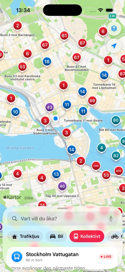
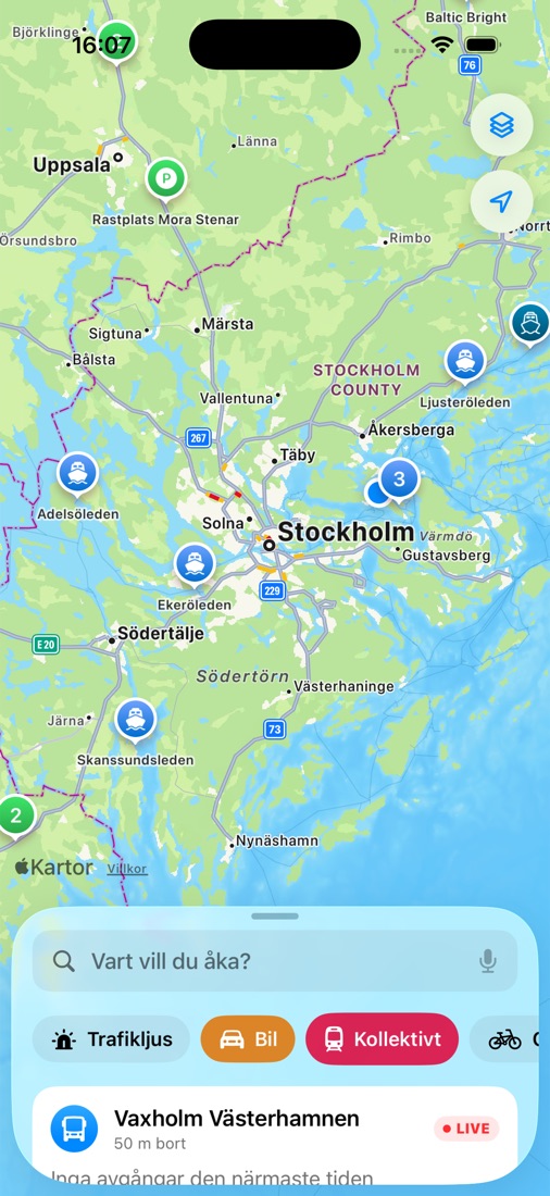
Vehicles move on the map with their line number, in 15 counties. Red is bus, blue metro, purple train and turquoise boat.
-
Queues and travel times
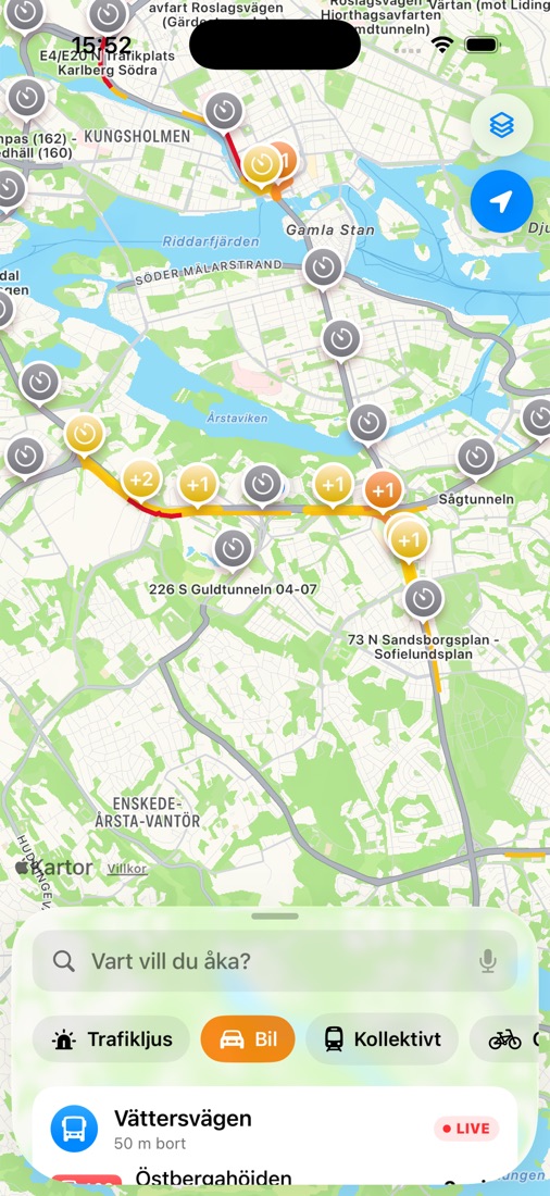
Measured travel times on Stockholm's main roads and tunnels, every minute. A queue shows as +2 minutes compared with normal.
-
Road conditions
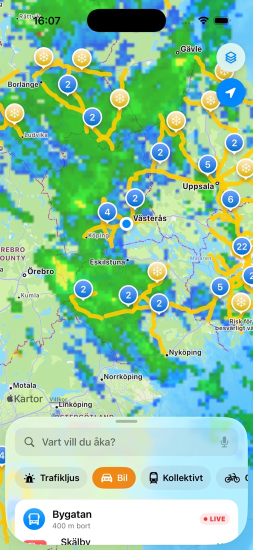
Snow, slush and ice on the roads as lines, with what is on the road and when it was ploughed.
-
Rain radar
Current precipitation from SMHI's weather radar, every five minutes. Blue is light, yellow and red heavy.
-
Disruptions and roadworks
Accidents, closures and roadworks from the Swedish Transport Administration, with place and time.
-
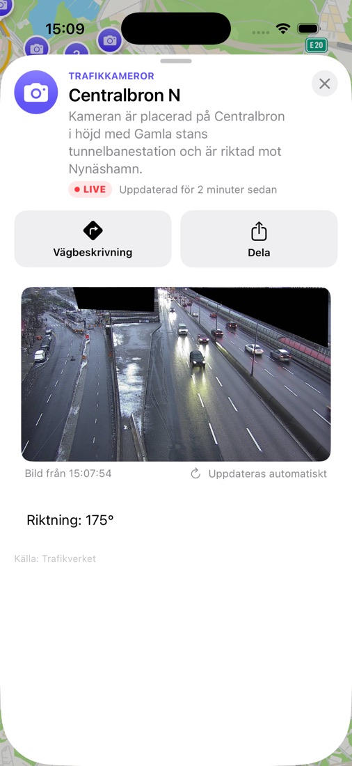
Traffic cameras
Tap a camera to see the road. The picture refreshes by itself while you look.
-
Ferries and ships
The next departure for the Swedish Transport Administration's road ferries, and ships moving at sea.
-
Parking at your destination
When you plan a trip by car, see parking near where you are going, with the number of spaces and the price. Free spaces show where the city shares them.
-
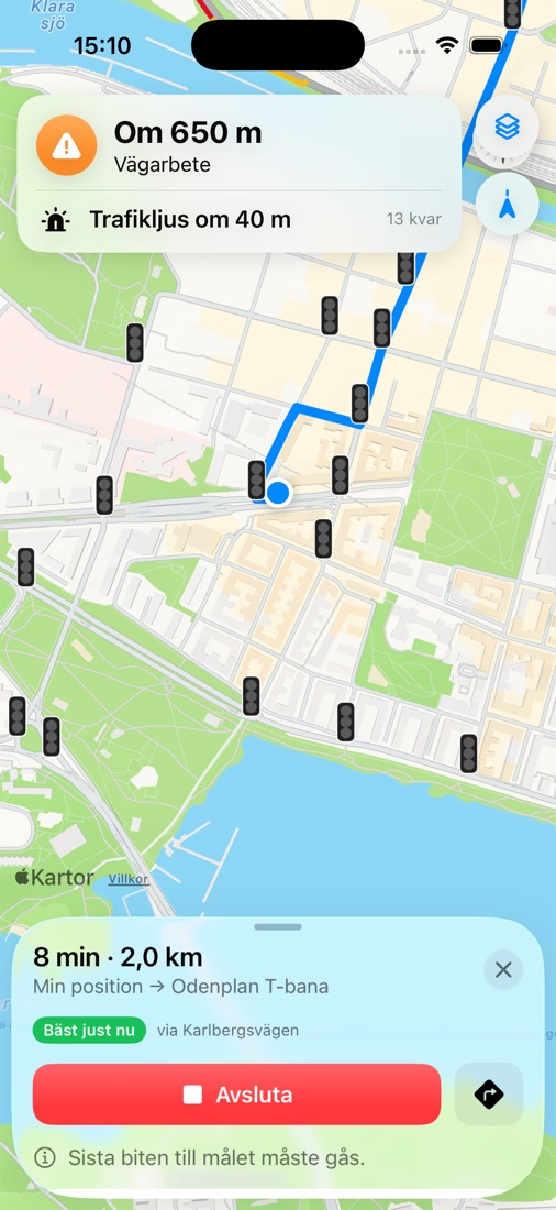
Traffic lights on the road
Where the next traffic light is when you drive. Colour and countdown will come when cities share their signal data openly.
-
Police, Krisinformation and SMHI
Incidents where you are, important public announcements and weather warnings.
What it looks like
Pictures from the app, taken with real data. The screenshots show the Swedish version.
From A to B
- Drive
- Transit
- Cycle
- Walk
Choose how you want to travel. 360Maps compares the routes with the traffic right now and shows what is along your way: queues, road conditions, roadworks, ferries and traffic lights. By public transport you get departures, delays and changes across Sweden.
On a trip by car, bike or on foot the next turn is read aloud, even with the screen locked. If you take a wrong turn the app finds a new route, and if it finds one that is at least three minutes faster it tells you. Near your destination you see where to park.
Open data, clear sources
Everything on the map comes from open data. Here are the sources and their terms.
| Source | Used for | Terms |
|---|---|---|
| Trafiklab and Samtrafiken | Real-time vehicles, departures, stops and journey planning across Sweden | CC0 and CC BY 4.0 |
| SL | Stops and disruptions in Stockholm County | Open data via Trafiklab |
| Swedish Transport Administration (Trafikverket) | Disruptions, cameras, speed cameras, road conditions, travel times, trains, road ferries and rest areas | CC0 |
| Oxyfi via Trafiklab | Train positions every second | Open data via Trafiklab |
| SMHI | Rain radar and weather warnings | CC BY 4.0 |
| Swedish Police | Incidents | Open data |
| Krisinformation.se | Important announcements and news | Open data |
| Fintraffic, digitraffic.fi | Ships (AIS) | CC BY 4.0 |
| City of Stockholm | Charging points, bicycle parking and toilets | Open data |
| Styr & Ställ and Lundahoj | Rental bikes (GBFS) | Open data |
| Stockholm Parkering | Car parks and visitor parking with number of spaces and price | Open data |
| OpenStreetMap contributors | Positions of traffic lights and car parks | ODbL |
| Wikidata, Wikipedia and Wikimedia Commons | The list of sights, their texts and photos, each photo credited in the app | CC0, CC BY-SA and the licence of each photo |
No ads, no account and no tracking. Your location is only used to show what is near you and to plan journeys. How we handle data.
Support
Found a bug, missing something on the map or have a question about the app? Email raztechsupport@icloud.com and we will reply. Answers to common questions are on the support page.